Maps
The Shahi kingdoms encompassed extensive temporal and geographic parameters, extending from Afghanistan to the borders of the Tibetan empire over a period of 300 years. We aim to define with greater precision the geographic boundaries of the kingdoms at different times over this long period. At present, we hope to define the boundaries of the Shahi kingdoms in the late 7th century; first half of the 8th century; and the mid-10th century.
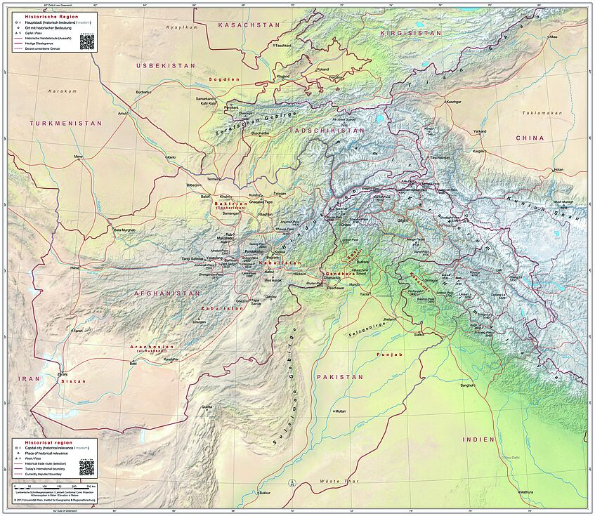
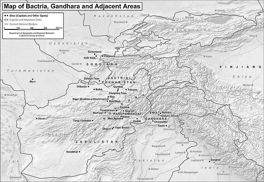
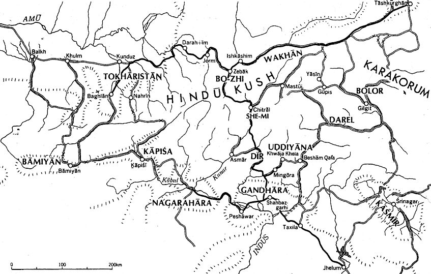
One of the goals of this project is to produce digital/analogue maps of the Shahi kingdoms at different points in time. The map designed by the CHIS in 2010 (as part of the FWF NFN #S98) will be augmented with additional features that our research has identified as significant for the political, economic, and cultural history of the Shahi kingdoms, including roads, routes, and cultural features such as archaeological sites, monuments, towns, and settlements, each with precise GPS coordinates and chronologies.
This map provides the foundational lexicon of geographical terminology for the project. Our objective is to reinstate the validity of the geographic designations used here. Our research on the material culture of the Shahi kingdoms has demonstrated that the different categories of portable objects (defined by material) have distinctive technical and cultural features which fall into chronological and geographic categories. These categories coincide with the smaller geographic units known from the primary sources and used by most scholars prior to the 3rd millennium CE. This map offers the clearest graphic depiction of these geographic units.
Interactive Map
The project’s final Interactive Map is a geo-referenced digital tool that was created in collaboration with the Austrian Centre for Digital Humanities and Cultural Heritage (ACDH-CH) at the Austrian Academy of Sciences and the Department of Geography and Regional Research at the University of Vienna in consultation with our international project consultants.
All primary source records in the database are cross-referenced with this map using precise GPS coordinates and chronologies (to the degree known). To visualize Shahi material culture across shifting temporal and geographical boundaries, the interactive map features the widest geographical extent of the kingdoms:
- North: directly below the Amu Darya River
- West: directly west of Tang-i Safedak (located just west of Bamiyan)
- South: directly south of Multan
- East: east of Srinagar and Jammu (in India's Jammu & Kashmir district)
Red circle symbols on the map indicate the locations of the primary source materials recorded in the database. A sliding time scale allows users to visualize the scope of Shahi material culture at different points in time, with material ranging from the 2nd-14th century to offer context beyond the Shahi period. This geographical and temporal scope is further contextualized by the scientific annotations in each record, the database Collections, and Sourcebook essays together with the articles by our scholarly network in the final publication. This has been a complex task from scientific and technical perspectives, and thus it will be improved with ongoing research, data input, and evaluation.


